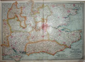
The table below lists flat maps of Essex in approximately chronological order; these are taken from Atlases, or in a few cases were published as maps of Essex alone. There is a link from each entry to a large picture.
There are no links to reference books on this page, as there are no reference books that I've seen to help.
The dimensions against each map are Height x Width, and as Essex is a little wider than it is tall the width is usually greater - assuming the map has north at the top. The measurements are of the outermost neat line of the map (not the size of the sheet of paper).
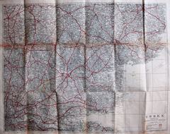
| Thumbnail maps |
Mapmakers, their Atlases and Maps |
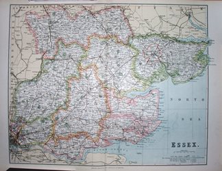 |
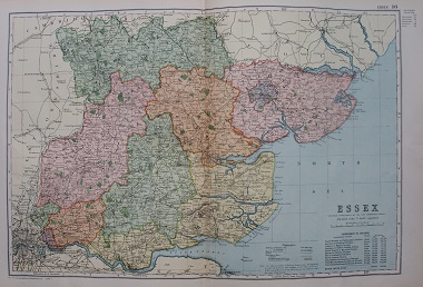
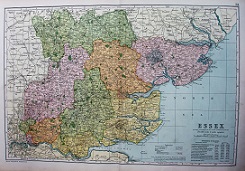
G Philip
Philips' Atlas of the Counties of England
1900 338mm x 417mm
Little changed from 1885. |
 |
G Philip
Cyclists Map of the County of Essex
1900 336mm x 418mm
The map now with Cyclists'information. |
 |
Jarrold & Son
Jarrolds' Map of Essex
1900 635mm x 806mm
Bartholomew's half-inch map without contour tinting. |
 |
GF Cruchley
The Half Inch Map of England
1900 514mm x 644mm
Gall & Inglis using Cruchley's, ie Cary's, old maps. |
 |
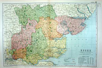
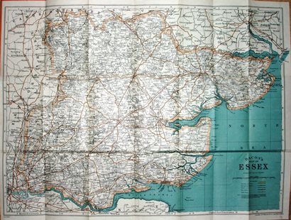
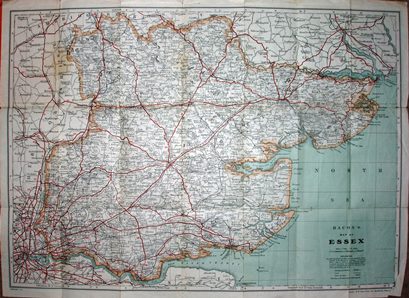
GW Bacon
Commercial and Library Atlas of the British Isles from the Ordnance Survey
1901 305mm x 457mm
Little changed from 1895. |
 |
Encyclopaedia Britannia Company
10th Edition
1902 266mm x 382mm
Less importance for counties than in the 9th edition. |
 |
G Philip
Philips County Cycling Map of England and Wales
1903 458mm x 571mm
A different & larger folding map from Philips. |
 |
E Stanford
Geological Map
1904 182mm x 239mm
Geology seems to have changed since 1860. |
 |
GW Bacon
Commercial and Library Atlas of the British Isles from the Ordnance Survey
1904 306mm x 457mm
An Atlas published many times. |
 |
W & AK Johnston
World-Wide Atlas
1905 199mm x 270mm
Regional maps added to 7th edition of Atlas. |
 |
W & AK Johnston
New Three Miles to an Inch
1905 617mm x 484mm
More sea than land on this one. |
 |
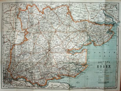
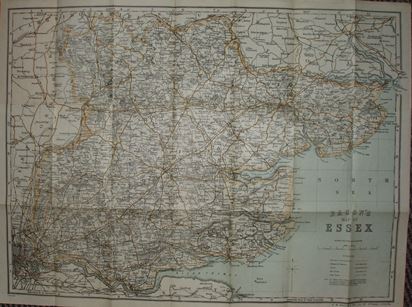
GW Bacon
Bacon's County Map and Guide
1906 455mm x 612mm
Our two cyclists have dismounted since 1896. |
 |
GW Bacon
Bacon's New Large Scale Atlas of London and Suburbs
1906 305mm x 459mm
The map updated and published in another atlas. |
 |
GW Bacon
Bacon's Library Atlas of the British Isles
1907 305mm x 459mm
An Atlas published many times (the name changes). |
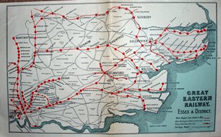 |
Great Eastern Railways
Great Eastern Railways: Essex & District
1909 263mm x 162mm
Highlights GER's tracks, and downplays other companies. |
 |
Methuen
Little Guide to Essex
1909 344mm x 425mm
Taken from Methuen's Little Guide to Essx, by J Charles Cox. |
 |
GF Cruchley
Gall & Inglis' County Maps of England
1910 481mm x 613mm
The title and the cover lives on, but the map changes. |
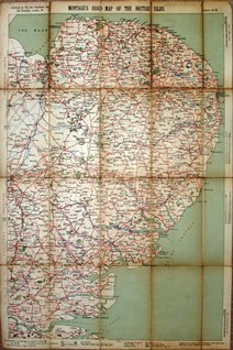 |
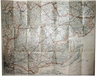
Montagu
Montagu's Road Map of the British Isles
1910 701mm x 463mm
The Car Illustrated (a magazine) produces maps. |
 |
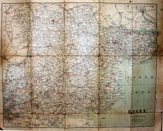
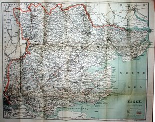
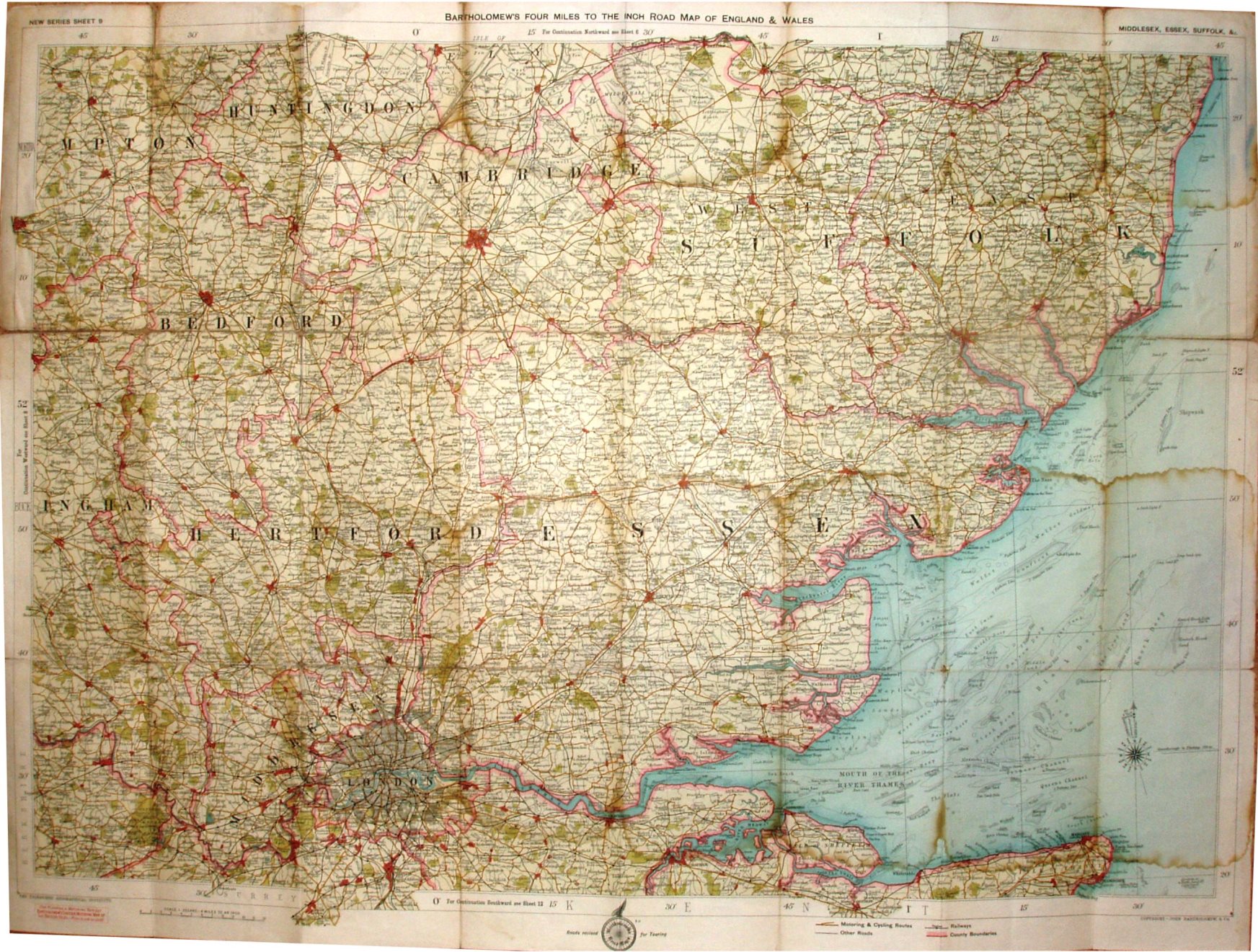
J Bartholomew
Essex
1910 519mm x 730mm
Bartholomew Half Inch maps published by Stanford. |
 |
GW Bacon
Atlas of London & Suburbs
1910 304mm x 458mm
Standard Bacon flat map, but in a London atlas. |
 |
GW Bacon
Bacon's County Map and Guide
1911 453mm x 622mm
Female cyclist consults the map as car drives past. |
 |
GW Bacon
Bacon's County Map and Guide
1912 454mm x 615mm
Female cyclist still consulting the map as car drives past. |
 |
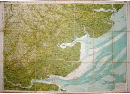
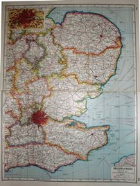
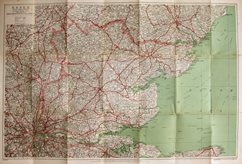
RAC & Philip's
RAC Touring Map of England and Wales
1912 745mm x 937mm
RAC starts off with half-inch Philip's maps. |
 |
GW Bacon
Bacon's Large Scale Atlas of London & Suburbs
1913 304mm x 457mm
Someone stole the map colouring. |
 |
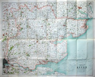
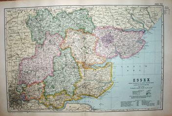
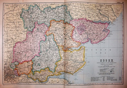
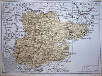
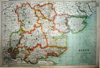
J Bartholomew
Essex
1913 507mm x 711mm
Bartholomew publishing Quarter Inch maps under own name. |
 |
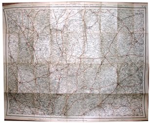
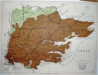
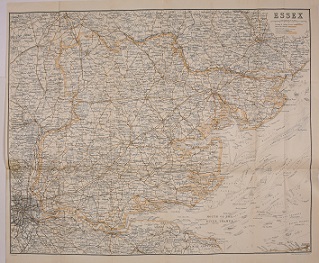
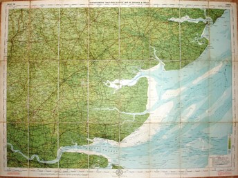
J Bartholomew
Essex
1914 520mm x 734mm
Bartholomew's iconic Half Inch map. |
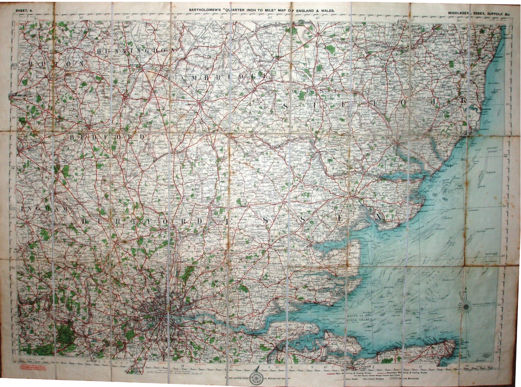 |
J Bartholomew
Essex
1919 513mm x 725mm
Bartholomew Quarter Inch map post WW1. |
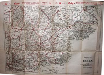 |
Jarrold & Son
Jarrolds' Map of Essex
1920 444mm x 634mm
Anonymously sourced map with a strange scale. |
 |
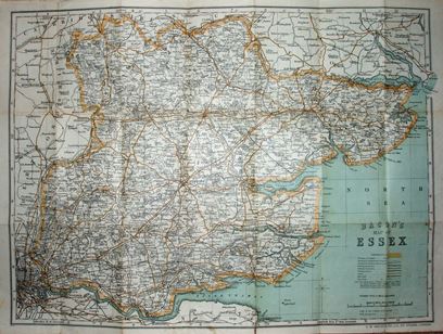
GW Bacon
Bacon's County Map
1920 428mm x 601mm
Now male cyclists consult the map. |
 |
Harmsworth
Harmsworth's New Atlas
1920 430mm x 322mm
Even in 1920 someone was proposing more railways. |
 |
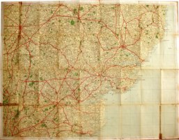
Geographia Ltd
Geographia's 2 Miles to the Inch
1920 737mm x 976mm
Very inferior to same sized Bartholomew maps. |
 |
Geographia Ltd
Geographia New Road Map
1921 412mm x 531mm
Really cheap map, three miles to an inch; weird cover design. |
 |
Geographia Ltd
Geographia Road Map of Essex
1922 476mm x 721mm
They continue with this series for over 40 years. |
 |
Geographia Ltd
Geographia Road Map of Essex & S. Suffolk
1923 741mm x 966mm
The maps continue despite the firm's financial troubles. |
 |
Geographia
Essex
1923 159mm x 220mm
Places and lines, but nothing else. |
 |
AA & Bartholomew's
Essex
1923 524mm x 731mm
Bartholomew's half inch map published by the AA. |
 |
Geographia Ltd
Geographia New Road Map
1924 409mm x 531mm
Really cheap map, three miles to an inch; plainer cover design than in 1921/22. |
 |
GW Bacon
Bacon's County Map
1924 428mm x 601mm
The two male cyclists still consulting the map. |
 |
GW Bacon
Bacon's County Atlas of England and Wales
1924 304mm x 449mm
Two identical maps, but with different plate numbering. |
